Project period: 2017 - 2020
Organisations: University of Texas, GNS Science, NIWA, Cal Poly Pomona University, University of Southern Mississippi, Pennsylvania State University, University of Southern California, Victoria University of Wellington, Imperial College of London, JAMSTEC
Project location: East Coast of the North Island of New Zealand
 From now until 2020, teams of scientists will be investigating the Hikurangi plate boundary that lies off the East Coast of the North Island.
This is where the Pacific tectonic plate subducts (or dives) under the Australian tectonic plate. These plates meet at what is called the Hikurangi subduction zone. Subduction zones are where the largest and most powerful earthquakes occur. Scientists want to find out more about how these two tectonic plates behave as they move past each other.
This research involves looking for evidence of past earthquakes, geological and geophysical mapping, ocean bottom seismology, and computer-modelling.
Geology: Scientists will be gathering geological evidence at key sites along the East Coast to look for signs of past large Hikurangi earthquakes. Like archaeologists, these scientists dig into the shallow earth to look for information from the past. Evidence of earthquakes that occurred hundreds or even thousands of years ago, can be preserved in the buried landscape beneath the surface. Information about the timing of past earthquakes can help us understand long-term behaviour of the subduction zone.
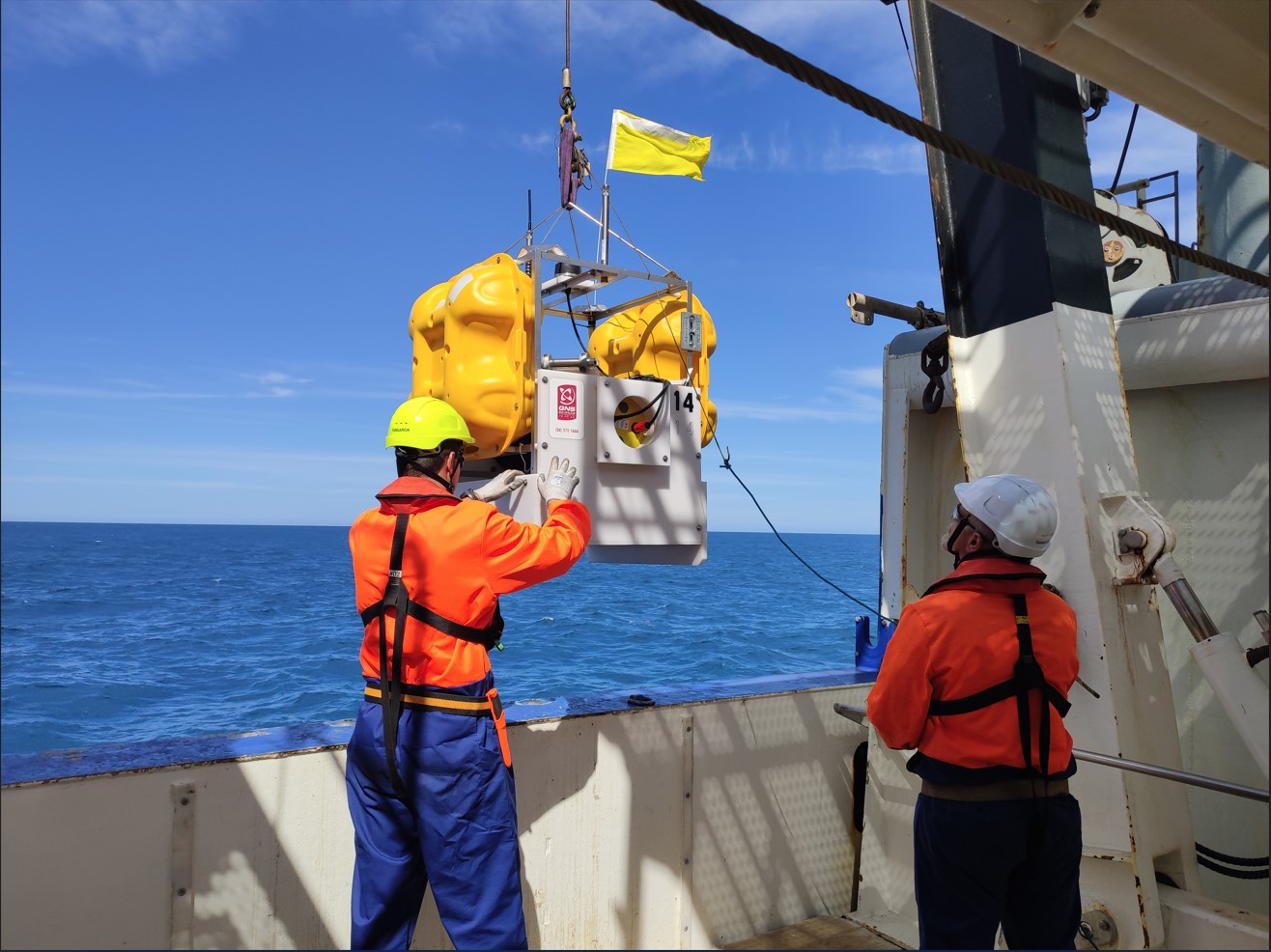
Geophysics: They plan to carry out 1,912km of geophysical surveys along and across the Hikurangi subduction zone. This includes installing 180 ocean floor sensors and 88 land-based sensors from November 2017 to February 2018. These surveys map where different layers of rock meet, and will enable scientists to interpret the layers and structures along the Hikurangi subduction zone
Modelling: All the geologic and geophysical data gathered as part of this project will be used to build a picture of the structure of the Hikurangi subduction zone.The structural picture, with the information on timing of previous earthquakes will be used to “rewind” the subduction zone model and learn what material properties and behaviours are necessary to build the structures we observe today.Once scientist understand these material properties and behaviours, the model of the subduction zone can be used to “fast-forward” and investigate future earthquake behaviour.

Scientists are asking for help to find a few earthquake instruments, belonging to GNS Science and Columbia Universi...
6 January 2020

A 100-kilometre long arrangement of earthquake sensors on the Raukumara Peninsula will help scientists build a clea...
25 February 2019

For the past couple of weeks, teams of earthquake scientists have been visiting remote sites in the region around G...
25 October 2018

Scientists have completed the retrieval of 89 land-based sesimometer stations that have been installed in the Gisbo...
5 March 2018

A team of scientists from California State Polytechnic University Pomona has been mapping and sampling marine terra...
5 March 2018

Scientists have been busy over the last month installing 88 portable seismographs across the Raukumara area in Gisb...
3 November 2017

Scientists are preparing for New Zealand’s largest ever deployment of seafloor earthquake recording instruments i...
17 October 2017
The project is a collaboration between scientists from NZ, the USA, UK and Japan. It is one of several large research projects working to better understand the Hikurangi subduction zone. For more information check out the Project Fact Sheet: Under the hood of an earthquake engine
Disclaimers and Copyright
While every endeavour has been taken by the East Coast Lab Hikurangi Subduction Zone M9 to ensure that the information on this website is
accurate and up to date, East Coast Lab Hikurangi Subduction Zone M9 shall not be liable for any loss suffered through the use, directly or indirectly, of information on this website. Information contained has been assembled in good faith.
Some of the information available in this site is from the New Zealand Public domain and supplied by relevant
government agencies. East Coast Lab Hikurangi Subduction Zone M9 cannot accept any liability for its accuracy or content.
Portions of the information and material on this site, including data, pages, documents, online
graphics and images are protected by copyright, unless specifically notified to the contrary. Externally sourced
information or material is copyright to the respective provider.
© East Coast Lab Hikurangi Subduction Zone M9 - www.eastcoastlab.org.nz / +64 6 835 9200 / info@eastcoastlab.org.nz