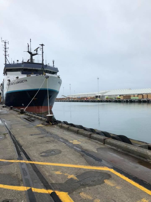
The US research ship, Marcus Langseth is at Napier Port today (Friday 9 February) after finishing a five-week study of the Hikurangi plate boundary off the East Coast of New Zealand.
The Hikurangi plate boundary is where the Pacific tectonic plate dives beneath the Australian plate and is called a subduction zone. Subduction zones develop a type of fault that are responsible for the largest earthquakes and tsunamis in the world, such as Sumatra 2004, Chile 2010, and Japan 2011.
The current study is focused on obtaining detailed images of where slow-slip events (or slow slip earthquakes) occur off the coast of Gisborne. Like earthquakes, slow-slip events involve more rapid than normal movement between the tectonic plates along the fault line. However, slow -slip events take place over a matter of weeks to months (rather than seconds to minutes, as in an earthquake). Why this occurs on some subduction faults but not others and what this tells us about the hazard these faults present remains a mystery to scientists.
The slow -slip events that occur offshore Gisborne are the world’s shallowest, which makes them more accessible and easier to study than others around the world. The region has consequently attracted international interest and funding for scientific projects to better understand subduction zones and the earthquake and tsunami risk it poses to coastal communities. It is important to remember that if you feel a long or strong earthquake then immediately get gone and evacuate to high ground.
The R/V Marcus Langseth has been working off the East Coast to produce CAT scan-like images that will show the structure of the Earth’s crust down to a depth of about 20km. It has been towing four 6km-long streamers, as well as acoustic source generators that use sensors towed behind the ship to pick up ‘echoes’ from different rock types in the upper layers of the Earth’s crust.
Alongside the ship’s acoustic sources, naturally occurring earthquakes have also been recorded on specially installed seafloor and land-based instruments.
Lead US investigator from the University of Texas, Dr Nathan Bangs says the project will use all the land and marine data gathered to produce detailed images of the source of slow -slip events offshore Gisborne.
“The intensive survey, being undertaken, northeast of Gisborne will produce three-dimensional images of the subduction zone both underneath the sea and beneath the land, and will help to reveal why slow -slip events happen there,” says Dr Bangs.
The images will show the position of the two tectonic plates and help scientists determine the physical properties of the various rock layers that make up the subduction zone and how this affects how the two plates move past each other. “Already the data acquired are revealing never-before-seen details of the shape and location of the subduction zone faults,” Dr Bangs reported.
Using this information, scientists can learn more about why slow -slip events occur, which is currently a mystery.
Members of the public will be able to see a virtual tour of the ship via the East Coast LAB Facebook page.
Disclaimers and Copyright
While every endeavour has been taken by the East Coast Lab Hikurangi Subduction Zone M9 to ensure that the information on this website is
accurate and up to date, East Coast Lab Hikurangi Subduction Zone M9 shall not be liable for any loss suffered through the use, directly or indirectly, of information on this website. Information contained has been assembled in good faith.
Some of the information available in this site is from the New Zealand Public domain and supplied by relevant
government agencies. East Coast Lab Hikurangi Subduction Zone M9 cannot accept any liability for its accuracy or content.
Portions of the information and material on this site, including data, pages, documents, online
graphics and images are protected by copyright, unless specifically notified to the contrary. Externally sourced
information or material is copyright to the respective provider.
© East Coast Lab Hikurangi Subduction Zone M9 - www.eastcoastlab.org.nz / +64 6 835 9200 / info@eastcoastlab.org.nz
