A newly-identified complex fault system north of Gisborne may shed new light on the risks of earthquakes and tsunami in the region, according to new research led by GNS Science.
The findings, reported in the Bulletin of the Seismological Society of America, suggest that distinctive marine terraces were caused by earthquakes on multiple offshore upper plate faults.
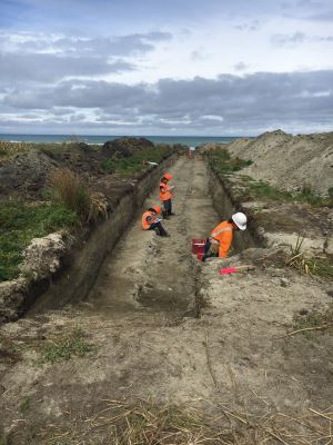
A team led by Dr Nicola Litchfield of GNS Science used radiocarbon and other methods to date the ages of marine terraces at two North Island sites, Puatai Beach and Pakarae River mouth.
Previously scientists thought the youngest terraces were created at the same time by a rupture in the Hikurangi subduction zone or a single-fault earthquake in the upper plate.
But radiocarbon dating of beach shells and layers of volcanic ash showed the uplift happened at different times.
“New research techniques allow us to build a high-resolution picture of where and how these uplifts occurred,” Dr Litchfield says.
“We’re now confident that each terrace represents an individual quake – and the patterns of uplift allowed us to map new offshore faults in the region.”
Dr Litchfield says the magnitude 7.8 Hurunui/Kaikōura earthquake in 2016 prompted seismologists to look closely at the mechanisms behind complex multiple-fault earthquakes.
She says this research will add to the growing understanding of the hazards posed to the East Coast by the Hikurangi subduction zone.
“Since the newly-identified faults are close to the coastline, this may mean short warning times for a tsunami."
This is why it is so important that people recognise the natural warning signs of a tsunami, a long or strong earthquake and immediately evacuate to high ground or inland.
“We need to learn more about these newly mapped offshore faults, how they might rupture together, and what they mean for the overall seismic hazard."
This study is part of a huge work programme led by GNS Science’s Dr Laura Wallace, funded by a grant from the MBIE Endeavour Fund – which aims to unlock the secrets of the Hikurangi subduction zone.
[YouTube id=WPvTNG_2nX0]
Disclaimers and Copyright
While every endeavour has been taken by the East Coast Lab Hikurangi Subduction Zone M9 to ensure that the information on this website is
accurate and up to date, East Coast Lab Hikurangi Subduction Zone M9 shall not be liable for any loss suffered through the use, directly or indirectly, of information on this website. Information contained has been assembled in good faith.
Some of the information available in this site is from the New Zealand Public domain and supplied by relevant
government agencies. East Coast Lab Hikurangi Subduction Zone M9 cannot accept any liability for its accuracy or content.
Portions of the information and material on this site, including data, pages, documents, online
graphics and images are protected by copyright, unless specifically notified to the contrary. Externally sourced
information or material is copyright to the respective provider.
© East Coast Lab Hikurangi Subduction Zone M9 - www.eastcoastlab.org.nz / +64 6 835 9200 / info@eastcoastlab.org.nz
