Scientists from New Zealand and Japan are collaborating with Chorus in a pilot project to investigate the subduction zone beneath the East Coast to learn more about its behaviour and the large earthquakes it can potentially produce.
They will spend the next two weeks based at Tolaga Bay making use of the Chorus underground copper wire telephone network in the area to measure small changes in electrical conductivity inside the subduction zone about 15km below this part of the East Coast.
The pilot is a joint research project involving Chorus, GNS Science, and the Earthquake Research Institute at the University of Tokyo.
It is the first time in New Zealand that a copper telephone network has been used for studying geological faults in the Earth’s crust.
The copper wire technique was pioneered in Japan and the East Coast has been chosen for its first full-scale trial to see if it can help scientists better understand physical changes inside the fault in the lead up to slow-slip events, which occur every 18 months to two years on this fault.
The umbrella term for the technique is magnetotellurics, or MT for short. It measures very low frequency electromagnetic waves that penetrate deep into the Earth’s crust. It enables scientists to build a three-dimensional picture of the subsurface down to a great depth - up to 100km depending on how long the MT data is recorded.
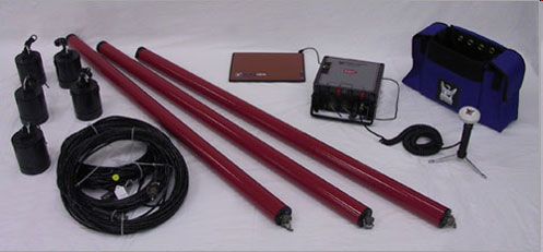
At the same time as the copper phone network is being used, staff from GNS science will deploy their own MT measuring equipment in the same area. Data recorded by the two methods will then be compared.
“Our hope is that by using Chorus’s copper network we will reduce ‘noise’ in the MT data to levels where we will be able to see small electrical conductivity changes inside the subduction fault zone during slow-slip events,” said project leader Grant Caldwell of GNS Science.
“If this trial is successful, we will have a new tool to probe the processes occurring in faults deep beneath the surface and improve our understanding of how the subduction fault works.”
“We are very grateful to Chorus who are generously supporting this research.’’
The interface between the Australian and Pacific tectonic plates is more than 10km below ground on the East Coast, and because of this it is a challenge for scientists to study. MT studies, when used in conjunction with other geophysical techniques, are a powerful tool for understanding the structure and behaviour of this large fault zone.
The Hikurangi subduction zone lies to the east of the North Island. It is where the Pacific tectonic plate is subducting beneath the Australian tectonic plate.
[YouTube id=S_012WXRd-Y]
Disclaimers and Copyright
While every endeavour has been taken by the East Coast Lab Hikurangi Subduction Zone M9 to ensure that the information on this website is
accurate and up to date, East Coast Lab Hikurangi Subduction Zone M9 shall not be liable for any loss suffered through the use, directly or indirectly, of information on this website. Information contained has been assembled in good faith.
Some of the information available in this site is from the New Zealand Public domain and supplied by relevant
government agencies. East Coast Lab Hikurangi Subduction Zone M9 cannot accept any liability for its accuracy or content.
Portions of the information and material on this site, including data, pages, documents, online
graphics and images are protected by copyright, unless specifically notified to the contrary. Externally sourced
information or material is copyright to the respective provider.
© East Coast Lab Hikurangi Subduction Zone M9 - www.eastcoastlab.org.nz / +64 6 835 9200 / info@eastcoastlab.org.nz
