Despite their potential for large, dangerous eruptions, much remains to be discovered about the type of volcanoes known as caldera volcanoes. A Victoria University of Wellington, Massey University, and GNS Science research collaboration is aiming to help change that.
“Past research in New Zealand has often focused on volcanoes like Mount Tongariro and Mount Ruapehu,
because they have erupted in living memory and pose a big risk to people with their proximity to ski fields,
roads, and popular walking tracks,” says Dr Finnigan Illsley-Kemp from the School of Geography,
Environment and Earth Sciences. “Caldera volcanoes are more complex and work on longer timescales,
so they are harder to understand, but this is a gap in our knowledge that needs filling.”
This expedition is part of the ECLIPSE project, a cross-disciplinary project funded by the Ministry of
Business, Innovation, and Employment aiming to understand more about the caldera volcano systems
between Lake Taupō and Rotorua. ECLIPSE researchers are studying the science behind past eruptions,
the present state of these volcanoes, the causes of non-eruptive volcanic unrest, and the oral histories of
iwi who live near these volcanoes which give insight into past volcanic and seismic activity.
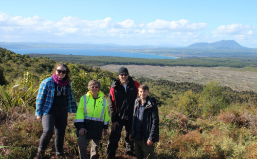
Dr Illsley-Kemp and his colleagues PhD student Eleanor Mestel, Dr Simon Barker, Bubs Smith, Professor
Martha Savage and Professor Colin Wilson are working to understand the present state of the Lake Taupō
volcano. Throughout October they have been placing seismometers into the ground which will monitor
seismic, or earthquake, activity in and around the lake.
“Earthquakes occur when there is volcanic unrest, so by tracking seismic activity we can track the
underground volcanic activity as well,” Dr Illsley-Kemp says. “We can also use the data to image the
volcano’s roots under the lake to find out how much magma, or molten rock, is there and where it is
located. We can use this information to help forecast when the volcano might erupt in the future.”
The seismometers will sit in the ground for two years, with the research team heading up there every three
months to download the data for analysis.
Dr Illsley-Kemp and the research team have worked with Ngāti Tūwharetoa to find the best sites for the
seismometers around the lake.
“We identified the best possible sites from a scientific perspective, and then we worked with
representatives from Ngāti Tūwharetoa to make sure we weren’t placing scientific equipment near wāhi
tapu sites, in and around the lake,” Dr Illsley-Kemp says. “We’re also working with the iwi to inform local
people about the work we’re doing and involve them in what we are doing around their lake.”
Dr Illsley-Kemp and his team will visit local schools and share the project with them, as well as taking
school children out into the field during fieldwork. Researchers from the ECLIPSE project were also
involved in an exhibit at Te Papa to educate visitors on caldera volcanoes and will also be heavily involved
in an international volcanology conference being held in New Zealand for the first time in 2021.
The data from the ECLIPSE project will ultimately be used to help prepare New Zealand for seismic and
volcanic events.
“We are working closely with Geonet and Civil Defence, especially with the groups that would actually
make decisions in an unrest event,” Dr Illsley-Kemp says. “A big part of this project is putting in place a
framework to get our scientific advice to the people that can use it, as well as make sure the public is
informed on what is happening and what to do in an emergency.”
Disclaimers and Copyright
While every endeavour has been taken by the East Coast Lab Hikurangi Subduction Zone M9 to ensure that the information on this website is
accurate and up to date, East Coast Lab Hikurangi Subduction Zone M9 shall not be liable for any loss suffered through the use, directly or indirectly, of information on this website. Information contained has been assembled in good faith.
Some of the information available in this site is from the New Zealand Public domain and supplied by relevant
government agencies. East Coast Lab Hikurangi Subduction Zone M9 cannot accept any liability for its accuracy or content.
Portions of the information and material on this site, including data, pages, documents, online
graphics and images are protected by copyright, unless specifically notified to the contrary. Externally sourced
information or material is copyright to the respective provider.
© East Coast Lab Hikurangi Subduction Zone M9 - www.eastcoastlab.org.nz / +64 6 835 9200 / info@eastcoastlab.org.nz
