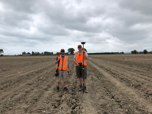
Researchers are carrying out soil testing across Hawke’s Bay to help better understand the potential shaking characteristics of future earthquakes.
They are using combination of techniques to understand the different soil profile characteristics across Hawke’s Bay.
The first technique they are using involves placing a large number of seismometers on the ground in a circular arrangement to record background vibrations from natural and manmade sources.
These seismometers measure vibrations in both vertical and horizontal directions.
Dr Liam Wotherspoon from the University of Auckland says how these vibrations travel across the array is affected by soil below – so by measuring these vibrations we can work out how the properties of the soil change with depth, from 20 m down to as much as 500 m.
The second technique involves placing a line of very sensitive microphones-like instruments called geophones, and then use a sledgehammer to create vibrations that travel along this line. This data will be used to understand the shallow soil, down to a depth of about 20 m.
Dr Liam Wotherspoon from the University of Auckland says the testing is being carried out in fields around Napier through to the end of February.
“We want to create a profile of soil stiffness from the surface to a depth of 500m at these locations to help us to understand the properties of the different soil layers and how they change with depth” says Dr Wotherspoon.
Past earthquakes across New Zealand and the world have shown that the soil profile has a significant influence on the potential shaking.
By collecting this data, the research can inform current building design practice and provides the basis for the simulation of potential future earthquakes using modelling approaches that are being developed by QuakeCoRE.
This research funded by the Earthquake Commission and QuakeCoRE, partners of East Coast LAB (Life at the Boundary).
Disclaimers and Copyright
While every endeavour has been taken by the East Coast Lab Hikurangi Subduction Zone M9 to ensure that the information on this website is
accurate and up to date, East Coast Lab Hikurangi Subduction Zone M9 shall not be liable for any loss suffered through the use, directly or indirectly, of information on this website. Information contained has been assembled in good faith.
Some of the information available in this site is from the New Zealand Public domain and supplied by relevant
government agencies. East Coast Lab Hikurangi Subduction Zone M9 cannot accept any liability for its accuracy or content.
Portions of the information and material on this site, including data, pages, documents, online
graphics and images are protected by copyright, unless specifically notified to the contrary. Externally sourced
information or material is copyright to the respective provider.
© East Coast Lab Hikurangi Subduction Zone M9 - www.eastcoastlab.org.nz / +64 6 835 9200 / info@eastcoastlab.org.nz
