Valuable insights into the risk of earthquakes and tsunami from New Zealand’s largest fault line will be gained after scientists successfully placed high tech earthquake recording instruments on the sea floor off the East Coast.
Despite rough seas and bad weather, 30 high-tech instruments were deployed to collect crucial data over the next 12 months, while another 10 instruments were retrieved from last year’s voyage.
The Hikurangi subduction zone extends along the length of the East Coast of the North Island. This fault poses a significant earthquake and tsunami risk to the entire East Coast of New Zealand.
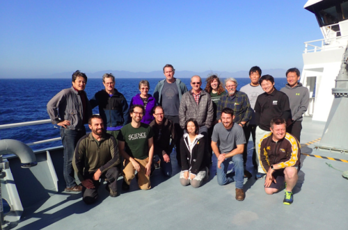
The international team on NIWA’s research vessel the RV Tangaroa included scientists from GNS Science and Victoria University of Wellington (NZ), Lamont Doherty Earth Observatory (US), Scripps Institution of Oceanography (US), as well as Tohoku, Kyoto and Tokyo Universities (Japan).
“Because so many interesting things are occurring on the Hikurangi subduction zone, New Zealand provides an ideal natural laboratory for these next-generation instruments”, says Professor Spahr Webb of Columbia University whose team has developed the Pressure Ocean Bottom Seismometers (POBSs).
Three different types of instruments were deployed, including Bottom Pressure Recorders (BPRs), Ocean Bottom Seismometers (OBSs) and the latest generation of Pressure Ocean Bottom Seismometers (POBSs).
These will measure the pressure at the bottom of the seafloor to record horizontal and vertical movement of the seabed at a centimetre level, as well as recording regular earthquakes and slow slip earthquakes.
“All these data will help paint a picture of the inner workings of the plate boundary offshore New Zealand’s East Coast,” says Dr Dan Barker, expedition leader from GNS Science.
The data collected will be analysed by two Victoria University of Wellington PhD students over the next few years for their doctoral research. While on board they blogged about their experience.
The recorders will give scientists additional information to the two ‘quake labs’ currently sitting 450m under the seafloor measuring temperature, chemistry and pressure changes at the Hikurangi subduction zone.
[YouTube id=0LTHrMb_6lc]
Disclaimers and Copyright
While every endeavour has been taken by the East Coast Lab Hikurangi Subduction Zone M9 to ensure that the information on this website is
accurate and up to date, East Coast Lab Hikurangi Subduction Zone M9 shall not be liable for any loss suffered through the use, directly or indirectly, of information on this website. Information contained has been assembled in good faith.
Some of the information available in this site is from the New Zealand Public domain and supplied by relevant
government agencies. East Coast Lab Hikurangi Subduction Zone M9 cannot accept any liability for its accuracy or content.
Portions of the information and material on this site, including data, pages, documents, online
graphics and images are protected by copyright, unless specifically notified to the contrary. Externally sourced
information or material is copyright to the respective provider.
© East Coast Lab Hikurangi Subduction Zone M9 - www.eastcoastlab.org.nz / +64 6 835 9200 / info@eastcoastlab.org.nz
