A 100-kilometre long arrangement of earthquake sensors on the Raukumara Peninsula will help scientists build a clearer picture of New Zealand’s largest and most active fault line.
During this week scientists from New Zealand, led by GNS Science, and the United States will use seismographs at 700 locations between Gisborne and Ōpōtiki to collect valuable insights into the Hikurangi Subduction Zone, the fault that runs under New Zealand’s East Coast.
The instruments have been shipped in from the US for the two-week duration of the project.
A large earthquake along the Hikurangi Subduction Zone could cause a devastating tsunami, and a better understanding of the fault will help communities along the East Coast become better prepared.
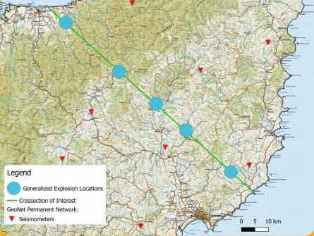
The seismographs will be placed 150 metres apart from coast to coast, and energy will be produced in boreholes creating a radiating signal to be recorded by the instruments.
The readings will help scientists build a three-dimensional image of rock structures beneath the ground, giving more information about the structure of the subduction zone.
“This technique is like producing a CAT scan of the Earth's crust,” says project co-ordinator Stuart Henrys from GNS Science.
“We know that in this region, the Pacific tectonic plate is being forced under the Australian plate – but in some places the plates are stuck, and the energy could be released in future earthquakes.
"We have a limited knowledge of how the plates are sliding past each other, so we’ll combine results from this project with our previous fieldwork to find out more about where the plates meet.
“The research will also reveal why some parts are locked and other parts are sliding freely."
This is one of several projects involving teams of scientists from around the world researching the Hikurangi Subduction Zone.
Harm van Avendonk from the University of Texas is the lead US scientist on the project, and he says the multiple projects represent a “step change” in understanding how subduction zones work.
“We can use the knowledge gained from this project to help understand other subduction zones around the wold and the devastating earthquakes they can generate,” Dr van Avendonk said.
Disclaimers and Copyright
While every endeavour has been taken by the East Coast Lab Hikurangi Subduction Zone M9 to ensure that the information on this website is
accurate and up to date, East Coast Lab Hikurangi Subduction Zone M9 shall not be liable for any loss suffered through the use, directly or indirectly, of information on this website. Information contained has been assembled in good faith.
Some of the information available in this site is from the New Zealand Public domain and supplied by relevant
government agencies. East Coast Lab Hikurangi Subduction Zone M9 cannot accept any liability for its accuracy or content.
Portions of the information and material on this site, including data, pages, documents, online
graphics and images are protected by copyright, unless specifically notified to the contrary. Externally sourced
information or material is copyright to the respective provider.
© East Coast Lab Hikurangi Subduction Zone M9 - www.eastcoastlab.org.nz / +64 6 835 9200 / info@eastcoastlab.org.nz
